What's new
DroidForums.net | Android Forum & News

This is a sample guest message. Register a free account today to become a member! Once signed in, you'll be able to participate on this site by adding your own topics and posts, as well as connect with other members through your own private inbox!

GPS in an airplane

Where does it say you are not permitted to operate a GPS on an airliner?
Usually in the magazine in the seat pocket. I think all but one airline in the US specifically bans the use of GPS on the plane (which is why "airplane mode" turns it off). I used to use my Garmin but stopped after being scolded by a flight attendant. Nowadays it's actually listed in the prohibited devices.

To add to this: the GPS is a receiver (much like a television or Radio), which are usually announced by the flight crew as prohibited items (please turn off all receivers including televisions, radios, etc.).

As for the signal, the body of the airplane really shields most Electromagnetic signals from within the cabin (unless you are near the window and can get a few satellites overhead that have a direct line-of-sight to the window side of the plane). Somebody said that airplanes use GPS - yes this is true, but in most cases the GPS antenna is mounted on the outside of the plane, with wiring running through the body of the plane to the GPS receiver.

Cheers,
B.D.
 
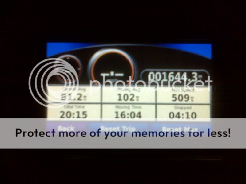
As you can see, my Garmin workes in flight. Kind of funny to watch it try to figure out where you are. They are not illegal to use but if a FA asks you to shut it off it would be best not to argue the rules and just shut it off. I'll try the Droid next flight.

IMG00076.jpg
 
All of my testing with GPS functionality has shown it needs a data connection. I fly helicopters and often use Maps or Google Earth while flying. With no data connection the map app and Google Earth will never resolve a position even though the GPS is banging away.

I read somewhere that the GPS in the Droid resolves position based on input from a data (3G or WiFi) source, it's not a full-blown, independent GPS receiver. That could certainly be wrong, but that's what I recall reading.

It may be that the GPS does everything it is suppose to but without a data source the APPLICATION using the GPS does not work correctly so at high altitude or in Airplane mode the applications that use GPS would not have the required data source.
 
I had my droid in airplane mode, then turned on my GPS. Ran track me (I think that is what it is called) and we were moving to fast for the the maps to show me anything but a line. I put mine to the window. It told me we were traveling around 800mph... Which is wrong since we were traveling around 400 mph or something close per the delta screen. Once on the ground though I check my tracks and we were flying over nashville per the map! LOL Kind of cool.
My woman was freaking out the whole time saying I was going to get us in trouble. whoops
 
All of my testing with GPS functionality has shown it needs a data connection. I fly helicopters and often use Maps or Google Earth while flying. With no data connection the map app and Google Earth will never resolve a position even though the GPS is banging away.

I read somewhere that the GPS in the Droid resolves position based on input from a data (3G or WiFi) source, it's not a full-blown, independent GPS receiver. That could certainly be wrong, but that's what I recall reading.

It may be that the GPS does everything it is suppose to but without a data source the APPLICATION using the GPS does not work correctly so at high altitude or in Airplane mode the applications that use GPS would not have the required data source.

A data connection is only required for apps that need to download information. This includes google maps/google earth.

For apps like GPS Status, which require no information to be downloaded, GPS works with no type of data connection. You can see this by going to the market and downloading GPS Status and Radar. Put your phone in Airplane mode and then run the GPS Status app. I am doing it right now in a concrete building which kills my signal (when its on) and my GPS is sitting at 24ft accuracy giving me the correct lat/lon.
 
I installed the GPS test app and then enabled airplane mode. It shut down the GPS. This appears to be a problem with the way airplane mode is set up.

We can tell this because your GPS will continue to work in navigation apps (when a route is cached) when you enter an area without cellular service.
 
I installed the GPS test app and then enabled airplane mode. It shut down the GPS. This appears to be a problem with the way airplane mode is set up.

We can tell this because your GPS will continue to work in navigation apps (when a route is cached) when you enter an area without cellular service.

I have no problem with GPS Status getting a fix, whether I put it in airplane mode before or after starting the program.
 
JP 5.56, you're right. I just tried again and it worked with both GPS Status and GPS Test.
The good news is, if there is ever a GPS app made that saves the maps to your SD card, rather than in the cloud. You wont need a data connection at all for mapping.

I think there is one out there that does this (CoPilot) but I am not sure.
 
No, you're right. I used Task Killer to stop all location apps before putting it into airplane mode. Both test programs I used were able to lock satellites.
 
I'm just wondering what all the other passengers were thinking watching you guys hold this little black electronic device up against the planes windows... lol
 
For my job I sometimes take a ride in a plane that one of my co-workers has to go to work (Mooney 201J). I can confirm that Google Maps and Google Tracks work in the air. The max speed was like 209Mph and we got up to about 10,000ft.
 
I downloaded GPS Status, then put my phone in airplane mode, and then turned on GPS Status. It's giving me the compass, my bearing and magnetic field information, and level data, but no actual location. Is that what y'all have been saying "it works with no data connection" for?
 
Back
Top